FARMTON

Farmton Mitigation Bank
SJRWMD: Halifax River (17), St. Johns River (Canaveral Marshes to Wekiva)(18), Econlockhatchee River Nested (19), Part of Southern St. Johns River (20), Part of Lake Jesup (23), Part of St. Johns River (Wekiva to Welaka)(14), Part of Crescent Lake (16),
- Located: Halifax River & St. Johns River (Canaveral Marshes to Wekiva) Basin
- Permitted by SJRWMD & USAOCE
- State: UMAM, Federal: WRAP
- Forested & Herbaceous Credits Available
Project Features
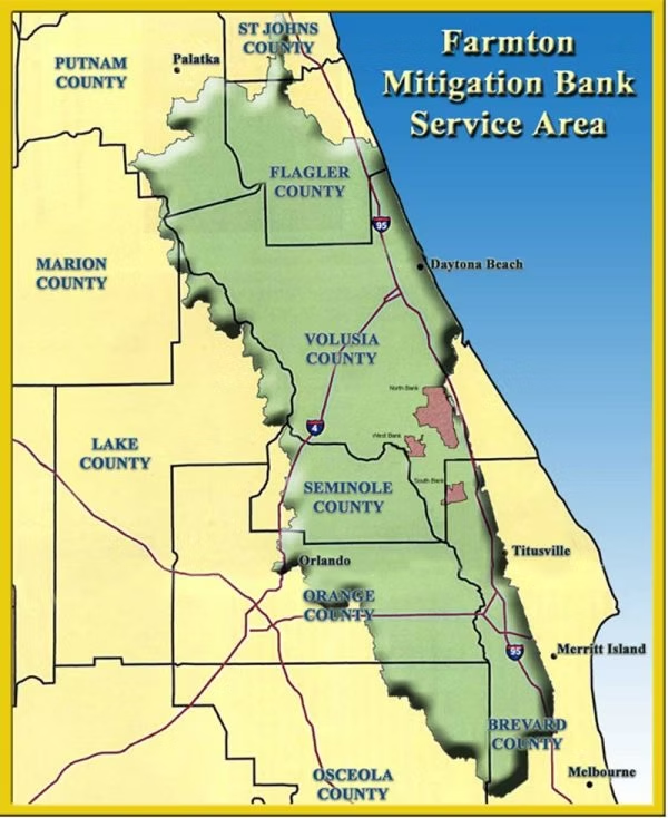
The Farmton Mitigation Bank covers a total of 23,922 acres, and is located at three sites (North, South, and West) in Volusia County. The North site covers 16,289 acres and includes Crane Swamp and a portion of the headwaters of Spruce Creek. The South site covers 4052 acres at Buck Lake. The West site covers 3,581 acres that include Cow Creek and Deep Creek. Habitats present on the three sites include cypress swamp, freshwater marsh, scrub/shrub wetlands, mixed forested wetlands, cypress/pine swamp, wetland coniferous forest, wetland hardwood forest, and uplands primarily comprised of pine flat woods and slash pine plantation, and to a lesser degree, temperate upland hardwood hammock.
Restoration and Enhancement Plan
The following ecological enhancement activities have been proposed or implemented at this mitigation bank:
- Hydro-logic enhancement through the installation of culverts under field roads, installation of weirs, and alterations to several bridges;
- Elimination of an open hunting plan and implementation of a wildlife management/hunting plan;
- Implementation of a native-community-promoting forest and timber management plan; and
- Recording of a Conservation Easement to eliminate cattle grazing from the property and prevent future activities not consistent with the preservation of natural communities.
