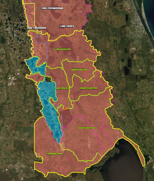
LAKE ISTOKPOGA BANK
Project Features:
The Lake Istokpoga Mitigation Bank (LIMB) in Highlands County, Florida, encompasses approximately 352.6 acres of wetlands and uplands directly connected to Lake Istokpoga, with a mission to create a self-sustaining wetland system that compensates for anticipated adverse impacts in its authorized service area. This initiative not only increases conservation lands in the Kissimmee River Drainage Basin but also enhances the ecological significance of the region, in accordance with state and federal regulations. LIMB’s multifaceted approach includes habitat rehabilitation, creation, and enhancement, benefiting a range of ecosystems like hardwood forests, wet prairies, and freshwater marsh habitats, all crucial for Central Florida’s wildlife. Furthermore, its hydro-logical connectivity positions it to offset wetland impacts from urbanization and agriculture, making it an invaluable resource for both public and private sectors.
Restoration and Enhancement Plan
The activities associated with LIMB include the following:
1. Enhancing vegetative communities by effectively controlling invasive and nuisance species across all assessment areas. The objective is to manage vegetative species to meet the final criteria of having less than 1% invasive or exotic species and less than 5% nuisance species.
2. Establishing hydro-logic function, hydro-periods, and floodwater attenuation through elevation grading in prairie creation areas. This will be assessed by automated hydro-logic monitoring wells, which record daily groundwater levels and generate hydrographs comparing water levels to ground elevations.
3. Improving wetlands and uplands by creating upland buffers. Both improved and unimproved pastures will undergo restoration with the establishment of native ground cover, and annual assessments will track progress toward achieving desired outcomes.
4. Ensuring the long-term preservation of target habitats through a conservation easement. In addition, a perpetual management plan, coupled with financial assurances, will oversee the control of invasive and nuisance vegetation and maintain accessibility to the mitigation areas.

